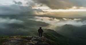
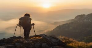
By late June, Bengaluru settles into a cool, overcast routine, but across the Western Ghats, the southwest monsoon arrives with full force. Heavy downpours wash over the shola forests and grasslands of Malnad and Kodagu, turning dry mud paths into rushways of mud and streamwater. For anyone living in Bengaluru looking to trade concrete for rain-soaked green, planning monsoon treks in karnataka requires an honest look at ground reality. Some popular peaks close down entirely when rivers swell, while other trails become manageable only if you arrive prepared for low visibility, saturated boots, and dense leech activity.
Walking the Western Ghats between July and September offers an incredible experience: swollen waterfalls, misty valleys, and streams flowing through deep valleys. However, taking on these trails during peak precipitation is not simply a matter of packing a poncho and driving down the highway. Forest Department regulations change quickly based on weather alerts, streams can rise within twenty minutes, and slipperiness on open granite rock faces turns moderate climbs into severe hazards. Knowing which routes remain viable and how to prepare makes all the difference between a memorable trek and an unsafe turn-back at a forest checkpost.
Forest Regulations and Trail Closures in Peak Rain
In recent years, the Karnataka Forest Department has implemented strict regulations to protect both trail infrastructure and hiker safety during heavy rainfall. High-altitude trails that cross major streams or feature exposed ridge lines are often shut down without long prior notice when red or orange alerts are issued for Chikkamagaluru, Shivamogga, Hassan, or Dakshina Kannada districts.
Peaks like Kudremukha and Netravathi frequently face administrative closures during July and August. In periods of relentless downpours, swollen forest streams cross the main paths, making ford crossings extremely dangerous. If you are tracking trail availability, review our update on Nethravathi and Kudremukha trek closures before planning a drive towards Kalasa. You can also consult our comprehensive Karnataka trek permits guide to understand how seasonal restrictions operate across various divisions.
All official trek bookings across Karnataka are consolidated under state forestry portals. For all details on trek slot availability, reservation policies, and official guidelines, check the Aranya Vihaara portal directly. Relying on outdated offline permissions or unverified local reports often results in being turned away at the forest gate after a long overnight journey.
Reliable Monsoon Trails in the Western Ghats
While high-risk high-altitude trails close during heavy rains, several lower-elevation and forested routes remain accessible and highly rewarding throughout the wet season.
Ettina Bhuja (Mudigere Region)
Located in the Charmadi Ghat range, Ettina Bhuja is roughly a 5.5-hour drive from Bengaluru via the Hassan-Mudigere highway. The trail ascends through thick canopy before emerging onto an open ridge leading towards an elephant-back-shaped peak. Because the forested portion shelters trekkers from wind-driven rain for most of the climb, it handles moderate to heavy showers remarkably well. The final ascent up the rock outcrop requires care when wet, but the overall route avoids dangerous stream crossings. Before traveling, check permit requirements through our guide on Ettina Bhuja permits on Aranya Vihaara.
Tadiandamol (Kodagu District)
Standing at 1748 m, Tadiandamol is the highest point in Kodagu and lies about a 6-hour drive from Bengaluru via Mysuru and Madikeri. The trail leads through coffee plantations, shola patches, and vast grassland slopes. During the monsoon, the lower forest section becomes a haven for terrestrial leeches, and thick fog frequently blankets the upper ridge line. However, because the main path follows well-established earth trails without deep river crossings, it remains navigable even during steady drizzle. For detailed terrain breakdowns, see our Tadiandamol trek guide.
Kodachadri (Shivamogga District)
Situated about an 8-hour drive from Bengaluru near Kollur, Kodachadri receives some of the heaviest rainfall in the region. The trail passing through Hidlumane Falls offers stunning torrents of water, though the rocky climb adjacent to the waterfall becomes very slick during active downpours. The jeep track route offers an alternative, safer line of ascent when stream levels rise too high. At Elneeru, when we take small groups through Shivamogga and Chikkamagaluru during peak wet months, we continuously assess local stream behavior and adjust routes on the trail to keep hikers safe.
High-Risk Routes and Trails to Avoid
Some iconic trails in Karnataka become distinctly hazardous during active monsoon months and are best deferred until October when the rain tapers off.
- Kumara Parvatha (Pushpagiri Wildlife Sanctuary): Accessible via Kukke Subramanya or Beedalli, this trail involves steep climbs over exposed granite slabs like Shesha Parvatha. In monsoon rain, these smooth rock surfaces transform into hazardous slip zones, while swollen forest streams near the middle checkpost become difficult or impossible to cross safely. The route is often subject to sudden Forest Department bans during peak rains.
- Netravathi Peak: Located near Kudremukha National Park, the trail involves crossing several unbridged mountain streams. Heavy rains in the catchment area cause water levels to surge unpredictably, stranding hikers on the far bank.
- Railway Treks in Sakleshpur: Walking along the green route railway bridges near Sakleshpur is illegal and heavily patrolled by railway security and forest guards. Landslides along railway cuttings and slippery metal viaducts make this route particularly dangerous during torrential downpours.
Practical Realities of Wet Weather Trekking
Walking through the Western Ghats during the rain requires shifting your expectations regarding gear, comfort, and pacing.
Managing Leeches
Leeches are an inescapable reality of monsoon trekking in South India. They thrive in wet leaf litter and grassy edges along the path. Trying to avoid them entirely is impossible. Wear tightly woven leech socks drawn up over your trousers, and avoid stopping under overhanging foliage. If a leech attaches, wait until you reach a clear resting spot to remove it gently without panicking.
Footwear and Dry Storage
Waterproof boots are often counterproductive on rain-heavy Western Ghats trails. Once water pours in from the top—which is inevitable in torrential rain—waterproof membranes prevent it from draining, leaving your feet soaking in heavy, waterlogged shoes. Lightweight, quick-draining trail running shoes or synthetic hiking boots with deep rubber lugs offer better traction on slippery mud and drain far faster. Inside your pack, line your rucksack with a thick trash bag or heavy-duty dry bag; rain covers alone will fail after two hours of continuous downpours.
Visibility and Trail Navigation
Misty conditions can drop visibility on open grassland ridges to less than ten meters within seconds. Always stay close to your group and refrain from wandering off established paths. Open ridges also expose trekkers to strong gusting winds and sudden drops in wind-chill temperature, so carrying a windproof outer shell is critical even when ambient temperatures feel mild.
Before heading out from Bengaluru on any weekend trip, always confirm weather forecasts with local forest division updates and secure official permits early. Check all administrative guidelines directly on the Aranya Vihaara portal to ensure your chosen trail is open and accepting visitors.